Milies – Panagiotiko dam – Boufa
Distance: 10,0 km
Duration: 4,5 hours
Marking: red signs
Maximum altitude: 378 m. (Mileon Square)
Drinking water on the route: no
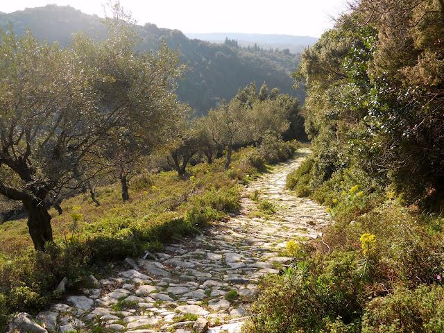
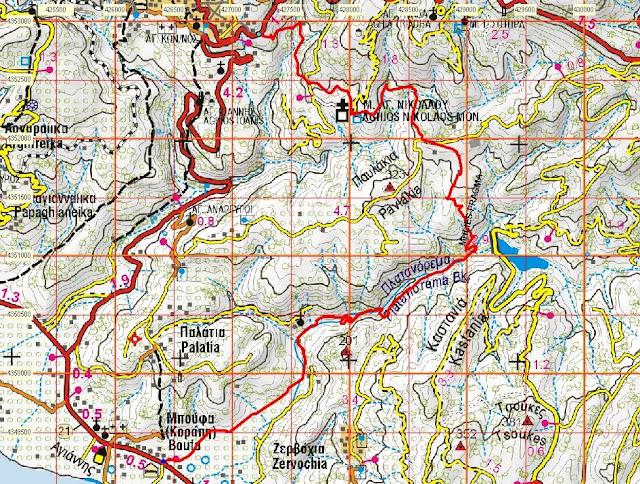
This route, which passes by many interesting points, begins with a nice cobbled path towards Pavlakia, then we move in the direction of Neochori until we reach the Panagiotiko dam and then we follow the Platanorema to the seaside settlement of Boufa. From there we can return to the starting point by taking the route from Boufa to Milies, thus completing the cycle, or take the bus to Volos from the main road of Boufa.
From the square of Miles we follow the asphalt road towards Volos. Eighty metres further on, once we pass a parking lot down on our right and the road makes a slight right turn, we take a diagonal left onto a wide paved cobbled road, which initially climbs slightly. At a junction of cobbled streets we take the rightmost one, which soon starts to go downhill. The cobbled road becomes a cemented road and comes out on the asphalt going towards Tsagarada at the last house in the village, at a point where the asphalt makes a left turn and there is a traffic control mirror.
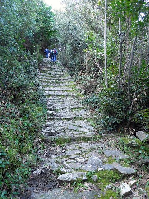
So we go down the cobbled road that continues across to a lush ravine. At a left turn that the cobbled street makes below, there is a right fork that served those coming from the train station. This fork ends on the main asphalt road of Miles, a hundred metres below the junction leading to the train station, on a sharp right turn of the road as it descends towards Volos.
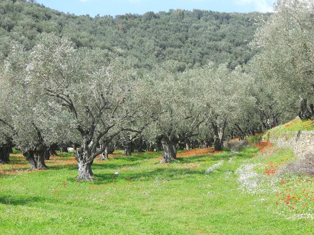
Our cobbled path, which is kept clean and in good condition, crosses the ravine and climbs up the opposite slope with an olive grove on the right. Reaching the top of the ridge, where we meet a rural road, there is a fork in the cobbled road. The right (southernmost) branch initially follows the course of the road (the cobbled path is visible in the road going downhill), and then, as the road makes a right turn below, it leaves the left side of the road as a path, but quickly becomes an impressive cobbled path again and passes a small stream. Then a path leaves to the left towards Agios Nikolaos, while the cobbled road continues and climbs up a slope coming out in an olive grove and from there as a narrow rural road comes out on a dirt road that comes from the settlement Stavrodromi, next to the place where the graves of three brave men executed by the Germans during the Occupation are located.
The left branch of the cobbled road from the point I mentioned above, crosses the rural road at an angle and descending slightly, it comes out on another road, which fifty meters further down leads us to the historic church of Agios Nikolaos. It is worth visiting this monument, a remnant of the monastery that used to exist here. Unfortunately, we will not be able to see the remarkable frescoes inside the church, except in the thieves through a crack in the wooden entrance door, which remains locked.
Returning upwards from the road we came from, after the left turn from Agios Nikolaos, we go right on a narrower dirt road and after a few meters we find on our left the continuation of the cobbled road, which to the west is closed by vegetation, but from this point onwards it is clear and we follow it in an easterly direction. We pass abandoned farms and after passing two small gullies, the cobbled road ends as it comes out on a rural road, which we walk uphill. The wider area here is called Pavlakia.
Above we come out on the dirt road that comes from the settlement Stavrodromi. If we go right, we will come to the graves of the executed I mentioned above and we will meet the other (southernmost) branch of the cobbled street. So we can make a circle to return to Milies. However, to continue towards the Panagiotiko dam, we go left (east) and in a hundred metres right (south-east) on a narrower dirt road, which leads us to a plateau with a threshing floor on the left and a row of cypress trees on the right. Here there is a crossing of paths. A path leaves the threshing floor on the left, entering the vegetation and descending initially in an east-southeast direction, passing two small gullies and coming out on a rural road just above Panagiotiko. Walking along this road, we can then descend to the dam. This alternative route, although a little longer, has the advantage of being smooth and avoids some of the pitfalls of the other route, which I will describe below.
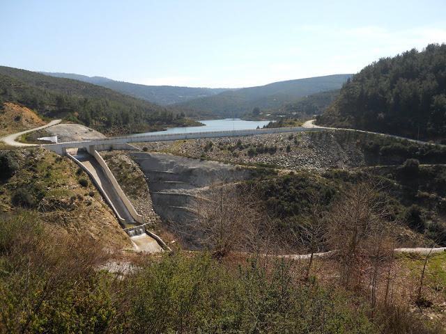
The other path then, after the cypress trees, turns diagonally right, descending southwards and scattering into parallel hedgerows, until it comes out on a narrow dirt road that was opened as a firebreak zone. We descend for thirty meters down the dirt road and then go diagonally left, on a path that is unclear at first (there are red signs), but then it becomes clear and descends steeply with zigzags in a south-southeast direction, until we come out on the slopes opposite the Panagiotiko dam. Here the ground has been completely altered by the construction of this technical project which, although it supplies drinking water to all of South Pelion from the small artificial lake that was created, it cost the destruction of a stone arched bridge that existed here (the bridge of Taratsas or Malamaki), of which only the photographs in the book of the late Nikos Charatsis “Stone arched bridges in Pelion” remain.
We descend freely down the cemented slope with care and reach below the dam, where we have to cross a small stream that runs next to it and climb with some difficulty to the road that runs across. Then we walk on this road going downhill parallel to Platanorema.
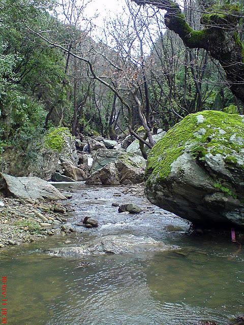
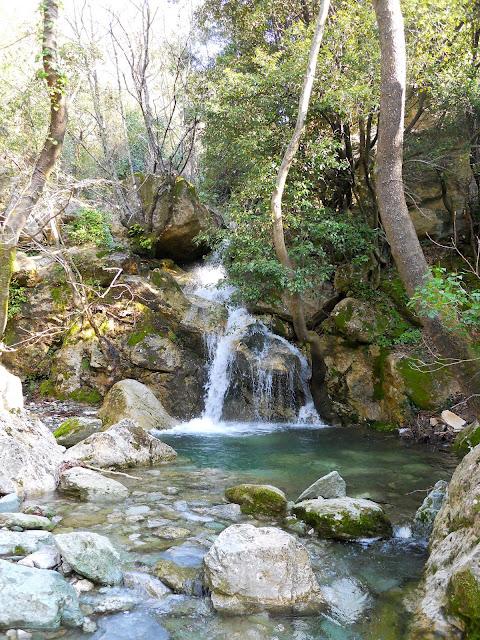
After a kilometer, as the road turns right passing a small stream, a few meters after the turn we find a path on the right that descends and we follow it. We’re about to cross. Go right and immediately the path splits in two. The upper path leads to an abandoned drystela. The lower path goes downhill, becomes a cobbled path for a while and reaches the stream where it continues on the opposite bank and after a while it passes again on the left bank, where there is a water pipe in the path, which drains the water to another dirt road further down. If the stream has a lot of water and we have difficulty crossing it, then turning back to the first crossing we go left and further on, where the path seems to be cut by a landslide, we freely descend a few meters down and find the path coming from the riverbed and follow it. If this descent to the sara seems difficult, turning back ten metres there is a fork that takes us up to the road and following it we find a path on the right, which meets the lower path we left and descends to the second restored dirt road, in a very beautiful spot next to the stream bed.
Leaving the dirt road, we walk on a path on the left bank of the stream that meets the road again below. We walk for a while on the left bank and then cross over, where we continue on a rural road between olive trees and a few huts. Below, the road becomes cemented and exits onto the main asphalt road. Walking to the right we reach in five minutes the church of Boufa, where the Milies-Boufa route ends.

