Keraamidi – Deer (O2)
Distance: 16 km
Duration: 4,5 hours
Maximum altitude: 671 m.
Marking: O2 signs and red markings
Drinking water on the route: no
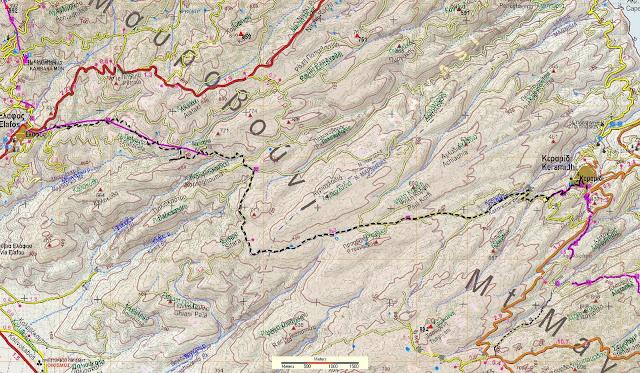
This route, part of the O2 national trail, begins with a cobbled path leaving Keramidi, then we walk for an hour on a rural road through wooded and bushy vegetation, and then we compensate by entering a wonderful oak forest until just before the village of Elaphos.
From the square of Keramidi we follow the main cobbled road that goes uphill. After a short while we meet the junction, where the cobbled road to the exit of the village to Volos goes on the left. We continue straight on, climbing uphill on a paved cobbled street. Arriving at the last house of the village, we leave it on our right and continue climbing uphill on a stone-built old cobbled street. We pass a small stream by turning right and after a while the cobbled path ends and becomes a wide path that leads to a wide rural road, where we walk in a westerly direction, climbing steadily. On the right side of the road, a little lower down, you can see the path that climbs parallel for a while and joins the road. We reach a quarry that we leave on our right and continue in a west-southwest direction, on ground with bushy vegetation. Now and then we can see remnants of a cobbled street.
After a long walk we reach a point where in front of us there is an elongated meadow with a waterhole (souvala Kallitsis). The main road we have been following so far turns right, but we continue straight ahead on a narrower rural road, which passes to the right of the souvala and continues on smooth terrain in a westerly direction. A little further on we find the path-calderm a few metres to the left of the road, but soon they merge again.
Our route now takes us through a beautiful oak forest, at an altitude of a little over 600 meters and from some points we see Lake Karla on our left. Our direction becomes north and eventually the narrow road we are following turns into a wider rural road. After reaching a plateau on the right with a small corral, we leave the road on the left, going downhill on a path and after a few meters we re-enter a rural road, which goes uphill heading generally west. At a right uphill bend we find the path again on the left side of the road and follow it in a westerly direction. At one point we will meet thirty meters of good cobbled road.
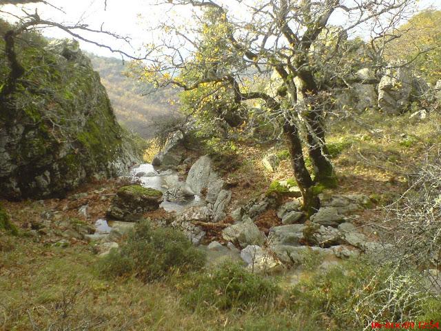
Reaching a small plateau, our course turns north again (right) and we descend, finding more remains of a cobbled path towards a beautiful gully, whose waters form a small waterfall a little further down (the Beyatiko stream). This is perhaps the most beautiful part of the route.
After crossing the gully, we descend to its right bank on a dense path, pass a second smaller gully and then come out in a clearing that we cross from its northern (upper) edge, heading west. Here the area is called Paliabella. We descend to a second clearing and walk on a dry stone terrace at its northern edge. Then we head northwest and after passing three small streams we climb up to a clearing with a corral, where a rural road passes. We follow it westwards and after a while, as the road turns left, we find the continuation of the path on the right side and we go downhill. Further down we meet the same road again and immediately leave it again to the right of the path. We get back on the road and a few meters ahead of us we have a crossroads that goes to a chapel on the left. Going downhill we get back on the road, avoiding the left hairpin bend it makes. We cross it diagonally to the right and in a few meters we find the continuation of the path, which after a while ends up at the northeast corner of the village’s football field. From the west side of the stadium we follow a road, which soon brings us to Elafos (formerly Vourgarini).


