Milies – Belegrinos – Milies
Distance: 8,4 km
Duration: 2.45΄
Maximum altitude: 378 m. (Mileon Square)
Marking: red signs
Drinking water on the route: no
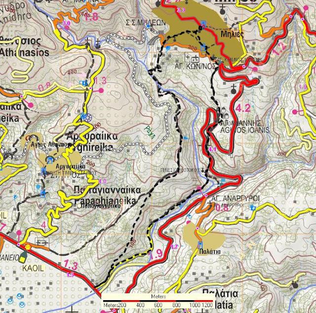
This is a circular route, starting from the square of Milies, which initially follows the cobbled road to Boufa and then descends parallel to the Milies gully, reaching the bridge of Belegrinos on the main road just after Kala Nera. The return is made from a connection with the main cobbled road Kala Nera-Milies.
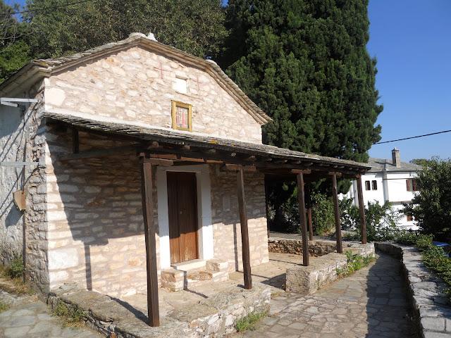
Starting from the square of Miles, we go downhill to the main cobbled road that leads to the station and after eighty meters, reaching the house of Daniel Filippidis, we go left at the crossroads (Kon. Filippidis street). We descend down the cobbled road, ignoring junctions that go uphill or turn right and in a short while we reach the beautiful church of Saints Constantine and Helen. We pass through the temple’s precinct and coming out on the asphalt road that leads to the station, we cross it and continue on a paved cobbled road that turns right after the last house of the village. To our left very close is the Volos-Mileon asphalt road.
A little further down we cross another narrow road that leads to the village cemetery. On our left is a complex of holiday homes. The cobbled road continues downhill to the right of the complex, and further on (be careful), reaching close to the asphalt road, it seems to turn right and passing by the chapel of Agios Ioannos Prodromos, it ends on the road. Just at the point of the right turn there is a junction and our cobbled road normally continues straight ahead, but it is blocked for forty metres by vegetation and so, until it is cleared, we have to walk alongside it a little to the left, climbing up to a farm. A little further on, it becomes passable again and we follow it, get on the asphalt, cross it and continue across. Here again we have a closed section for forty metres and again we walk a little to the left into a farm.
Eventually we re-enter the cobbled road, which from here on is no problem, we cross the asphalt again and a little further on we have a new junction. A branch turns left, going towards the bridge of Tsipokalamos and Boufa. On the right, a narrow cobblestone path leads to the small chapel of the Nativity of the Virgin Mary, hidden among the lush vegetation. We continue straight down and descend to the bed of the Milos gully.
On the opposite bank a path-calderimi continues parallel to the stream between olive trees. After a while we descend from a path into the stream, as a landslide has washed away the cobbled path here, and we walk for fifty metres through the bed, until we reach a fountain-top on the right bank. Next to the fountain we find the continuation of the cobbled path, which continues parallel to the stream. Finally, we take a diagonal exit onto a rural road, which continues to follow the right bank of the stream, until we meet the main Volos-Tsagarada road. This area, where the Miliotiko stream flows out, is called Belegrinos. It took us about an hour and fifteen minutes to get here, a distance of 3.9 kilometres. If we walk to the right on the asphalt road, we will reach after one kilometer the Tsitsilianio hospital and the starting point of the Kala Nera-Miles route.
To return now to Milies, walking backwards on the same rural road, a hundred metres further up we have a house on our left with a wide iron gate on the side. Opposite the gate, a path climbs uphill through the olive grove, which further up turns into a cobbled path and finally comes out onto a rural road at a bend. We follow the road straight uphill and after about four hundred meters, taking care on our left, we see the stones of the cobblestone road that cuts off from the road. We ascend with some difficulty to the bank of the road and, after climbing for a few meters on an unclear path, we immediately come out on another road and see the cobbled road opposite that continues to Milies. Here we meet and follow the route Kala Nera-Miles, until we reach the village square.


